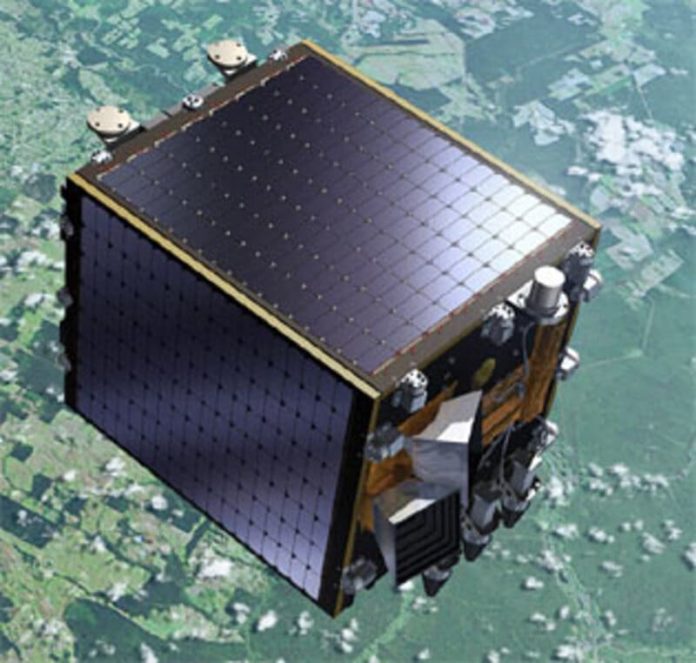
Proba 5 (Project for On-Board Autonomy) is an ESA mission dedicated to in-orbit technology demonstration, near-Earth environment monitoring and preparatory Earth observations.
| Name of Satellite | Proba 5 (Project for On-Board Autonomy) |
| Purpose | Earth Observation |
| Contractor | QinetiQ Space Belgium |
| Country of Contractor | Belgium |
| Launch Mass (kg.) | 140 |
| Class of Orbit | LEO |
| Perigee (km) | 813 |
| Expected Lifetime (yrs.) | 2,5 |
| Date of Launch | 07.05.2013 |
| Launch Site | Guiana Space Center |
| Launch Vehicle | Vega |
| COSPAR Number | 2013-021A |
| NORAD Number | 39159 |
PROBA 5 Earth Observation Satellite is a small spacecraft equipped with a selected set of technologies that provide advanced on-board functions to support mission operations with minimal ground involvement.


How many active satellites are orbiting the Earth right now?
Thx
how many solar panels to run a mobile home?
Who was the first person to be in space?
At what time of day and in what direction is it most profitable to launch artificial satellites and space rockets from the territory of Russia, so that they move with maximum speed?
Regards
Mike Morrison
Hilkom Experts
How many satellites are there in Earth’s orbit? What happens to them when they reach the end of their useful life?
Monkey Digital
Hi, very cool reviews! Have you collected all the satellites to date?
Regards
Mike Roger
Digital Experts
Ithink other web sote proprietors should take this site as an model, very clean and excellent user genial style and design, let alone the
content. You’re an expsrt in this topic!
Interesting approach, I would like to explore the topic in more depth.
Tell me how communication satellites differ from navigation satellites?
What are the main stages of developing and launching a satellite into orbit?
How do satellites influence the development of global navigation and cartography?
The future of satellite technology promises amazing new discoveries and achievements. With the development of small satellites (cubesats) and more powerful rockets, space is becoming more accessible for research and applications in various spheres of human activity.
Some satellites are used to map the Earth. They can provide high-resolution images that are useful for geological studies, urban studies and agriculture.
Satellites can be used to create global internet systems. The Starlink programme being developed by SpaceX involves launching thousands of satellites to provide high-speed internet around the world.
Orbiting the Earth is the International Space Station (ISS), which is not a satellite in the literal sense, but is used to conduct numerous scientific experiments in microgravity.
Many satellites are used for scientific research. They study the Earth’s magnetic field, cosmic radiation and other phenomena that are difficult to study from the planet’s surface.
Space telescopes like the James Webb Space Telescope (JWST), slated for launch, represent a new step in exploring the universe using cutting-edge technology.
Some satellites are specifically designed to monitor natural disasters. For example, they can track hurricanes, earthquakes and volcanic eruptions to help rescue services in their work.
The Hubble satellite, launched in 1990, is one of the most famous space observatories. It has made many important discoveries and provided mankind with stunning images of distant galaxies.
There are several spacecraft orbiting Mars that study the planet from orbit, such as NASA’s Mars Odyssey and Mars Reconnaissance Orbiter.
In addition to GPS, there are other global positioning systems in the world, such as GLONASS (Russia), Galileo (European Union) and BeiDou (China).
GPS (Global Positioning System) is one of the best known systems that uses satellites to provide real-time location and time determination to any user with an appropriate receiver. The system includes 31 operational satellites.
Satellites can monitor climate change and environmental conditions. For example, NASA satellites measure sea ice levels in the Arctic and Antarctic, which helps scientists better understand global warming.
A geostationary orbit, in which satellites “hover” over the same point on the equator, is located at an altitude of approximately 35,786 kilometres above the Earth. Such satellites are often used for telecommunications and synoptic observations.
Satellites account for about 30,000 pieces of space debris, including debris from old vehicles, rocket upper stages and even lost astronaut instruments.
There are currently more than 2,000 active satellites orbiting the Earth, performing functions ranging from navigation and communications to climate and weather monitoring.
The first artificial Earth satellite, Sputnik 1, was launched by the Soviet Union on 4 October 1957. This event marked the beginning of the modern space age.
Satellites are natural and artificial. Natural satellites, such as the Moon, orbit planets naturally, while artificial satellites, such as telecommunications satellites, are launched by humans.
What legal and ethical issues are raised by the use of satellite technologies?